I’ve been wanting to go visit the Cheltenham Badlands ever since reading about it in a blog article a few years ago.

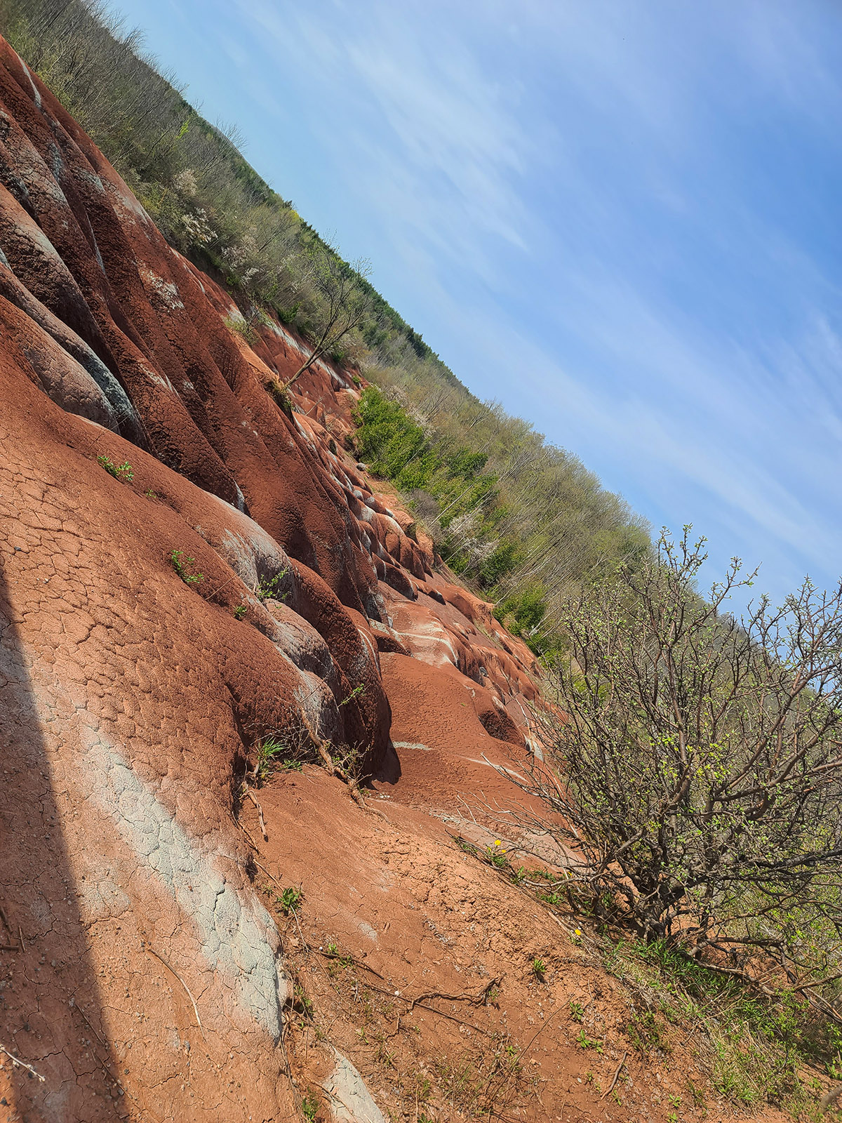
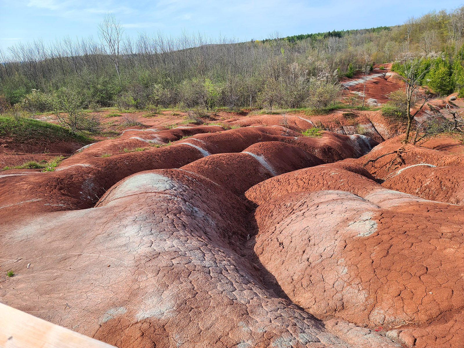
The badlands formation is an area of stunning red clay hills with faint green streaks.
The unique landscape is part of the Niagara Escarpment, an ecologically significant area in between the shores of several of the great lakes.
The Niagara escarpment is home to many conservation projects, several of which we’ve either visited or are planning to. There are a LOT of Ontario’s geological treasures in our surrounding area!
It’s the perfect time of year for it, too - cool enough for me to handle, early enough that there weren’t any crowds to deal with.
Still, we decided to plan for a weekday visit, to further minimize the potential crowds. We paid our reservation fee a few days ago, and visited this morning.
What a great place!
We had a fantastic walk and enjoyed the views, here’s what we learned, saw, and experienced!
Btw, today makes 9 days in a row with a long walk on each day. My legs hate me .. But I did it!

yes, we got cheesy. I do like this photo, though!
About The Cheltenham Badlands
The Cheltenham Badlands is a property owned by the Ontario Heritage Trust, involving a couple of hiking trails, and a boardwalk / viewing platform overlooking the unique ridge formations of soft shale in the “badlands” area.
It’s one of the most popular and recognizable natural heritage landmarks in the area, and one of the best examples of the importance of conservation work, IMHO.
The history of the area has been traced back to the ancestors of the Mississaugas of the Credit, who hunted, fished, and farmed in the area over many generations.
European settlers developed the land, and by the early 1900s it was being used as productive farmlands. There were several crops - including an apple orchard.
Poor farming practices and the removal of trees led to erosion of the soil cover, exposing the underlying shale.
The formations that we see today are the result of not only that erosion of the shallow topsoil, but also the effects of the conditions the shale was then exposed to.
Years of rain, snow, ice, and resulting thaw conditions have all contributed to erosion of the shale, forming the visually stunning appearance the area is known for.
The Trails
There are 3 trails on the Cheltenham Badlands property:
Boardwalk - 0.6 km
Badlands trail - 0.32 km
Bruce Trail 1.33 km
It’s kind of a y shaped set up.
You walk the badlands trail from the parking lot, it’s just a short walk to the trail divide.
If you go to the left, it’s a 1.33 km section of the Bruce trail, ending at Creditview Rd.
Going to the right, it’s just a short walk to the badlands viewing area.

The Bruce Trail
I was feeling pretty cocky about my ability to walk at this point, so I totally believed the employee when she said it was an easy walk.
It... really wasn’t!
Yes, my feet are still a bit weak and wonky from 2 years of dealing with flurorquinolone toxicity, but to be fair ... even my runner husband said that it was fairly challenging.
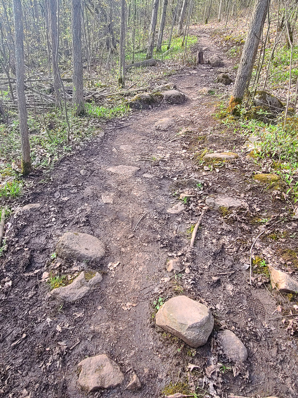
There were some very steep sections, and a lot of very uneven ground.
It was a really pretty walk though, and we were kept company by a LOT of blue jays! There was one particular section of the trail - early on - where we saw at least a dozen of them.
I usually feel lucky to see *A* blue jay when I’m out and about! They were all screaming at each other for that section, even when we couldn’t see them.
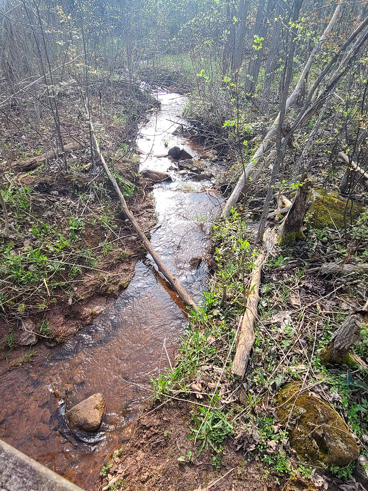
We got to the end of the trail section - at Creditview rd - and turned around, heading back to the trail divide and on to the viewing area.
I suppose you could probably keep going on the Bruce trail from Creditview rd, but we didn’t bother crossing the street, so I’m not sure how / if it continues from there. So, we treated it as a there-and-back trail.
The Boardwalk and Viewing Platform
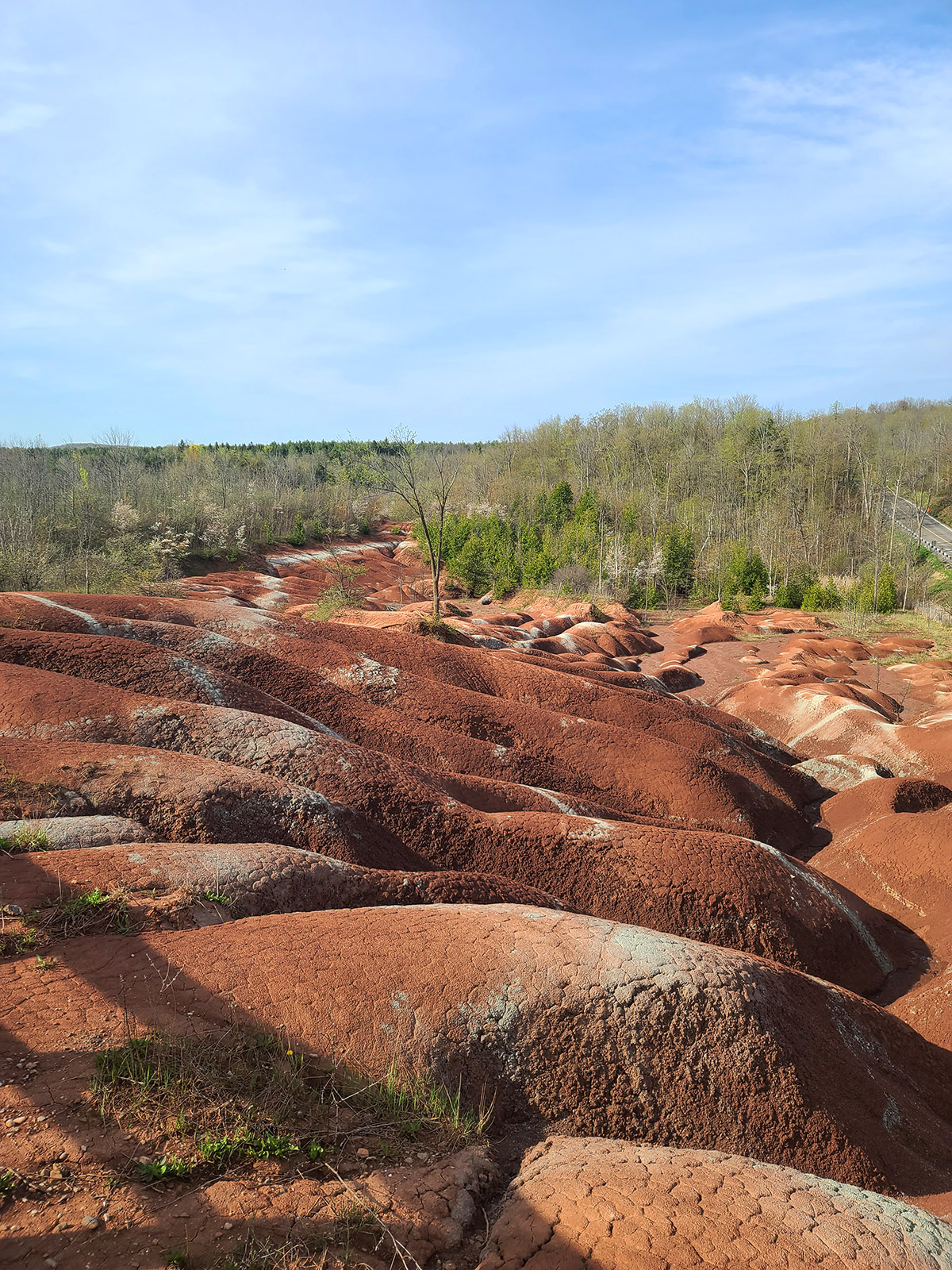
After making it back to the trail split, it was just a short walk to the viewing platform area, and it was a gorgeous view!
My photos in no way do justice to the reddish hue of the Queenston shale, or the narrow greenish bands all over the red rock. I think they look kind of white in my photos - that’s actually green iron oxide you’re seeing in the light stripes!
The red is iron oxide as well, the green areas are areas that show the change of red iron oxide to green, due to circulating groundwater.
This whole area of soft rock was formed at the base of an ancient sea, hundreds of millions of years ago. How cool is it, that we can see this, today?
On one hand, I’m glad it’s been preserved - sounds like people were destroying it. I don’t doubt it!
On the other, a friend of mine mentioned that she had wanted to go there to take cosplay photos in her Star Trek original series costumes, and... man, that would have been amazing!
Planning Your Visit
The Cheltenham Badlands are located in Southern Ontario, just north of Brampton. It’s in the Caledon region, on east side of Olde Base Line Road.
The physical address is 1739 Olde Base Line Road, Caledon, ON L7C 0K6.
Coming from 10 / Hurontario, it’s just past where the Chinguacousy Roads cross Olde Base Line.
It was just over an hour drive for us, coming from Hamilton - we left early enough to avoid rush hour traffic.
Book Ahead
Due to capacity restrictions, bookings are required to visit the badlands. These can be made on the Credit Valley Conservation website
They mentioned taking a limited number of walk-ins, but unless you live very close, I wouldn’t take the risk of it being full. There are a limited number of parking spaces, after all.
Admission fees are $10 per booking if you go Monday-Thursday, or $20 if you’re going Friday-Sunday, or on a holiday. (Plus HST, of course!)
While they don’t offer refunds (this is important in the case of wet conditions, more on that in a minute!), they do allow for changes to your reservation.
You can either rebook the date/time, or take a credit that can be used at either The Cheltenham Badlands or Belfountain Conservation Area.
As a bonus, the booking fee also gets you same day entry to Terra Cotta Conservation Area and Island Lake Conservation Areas - assuming capacity allows at the time.
We did not take advantage of this, as it was getting hot and my feet were pretty DONE by the time we left.
Parking
There is a smallish parking lot at the main gate, and a single (maybe 2?) accessible parking spot at the gate outside of the viewing platform, just up the road.
The booking fee also serves as a parking fee, and buys you 1.5 hours.
The parking restrictions definitely allow enough time if you’re just going to the viewing platform, but is a bit rushed if you do the trail as well.
If it’s not your first time there, or you hike *with purpose*, it should be enough time. It just felt rushed trying to enjoy the scenery our first time there, with the clock ticking.
Also note: If you arrive more than 20 minutes after your reservation time, you’ll be turned away.
Washrooms
There were several Port-a-potties in the parking lot, and they seemed well maintained.
We didn’t see more any along the trails or at the viewing platform.
Accessibility
If you use a wheelchair, the accessible boardwalk is basically all you’re going to be able to access.
For those who have hampered mobility and do not require a wheelchair (crutches, boot, etc), you can probably walk from the main parking lot to the viewing platform.
If you have any mobility concerns, I wouldn’t recommend walking the longer trail.
There are steep areas, narrow areas, very rough areas, and just weird angles to walk. There aren’t really any spots suitable for sitting down.
If I’d still been in a boot, I definitely would have hurt myself trying to navigate that trail.
If you need the accessible parking space, that needs to be reserved separately, here, and requires a valid accessible parking permit.
Other Info
When the trail gets wet and slippery, it’s closed for public use as a safety measure.
In this case, they’ll have you walk up the sidewalk along the main road, to go directly to the viewing platform boardwalk area.
Personally, I’d just re-book the date and time if it’s been rainy.


Leave a Reply